A Vision Plan
Designed to help communities imagine, explore, and organize — and then connect with funding sources to make common visions a reality.
A Vision Plan for the Gateway Cities
Home to over 2.1 million people, the plan area encompass 27 cities* and County unincorporated areas in the Gateway Cities region around the lower Los Angeles and San Gabriel Rivers in Southeast Los Angeles County. The communities of the Gateway Cities are among the densest and most diverse communities in the country. Yet just less than a century ago large portions of this region were rich agricultural fields built on floodplain across which two of the region’s great rivers occasionally merged. The transformation of the Gateway Cities from agricultural fields to densely urban communities makes for a richly told story. However the pattern of urbanization that characterized the rapid development of the region in the 20th century together with climate impacts and growing demands may also present challenges, from air quality to improving health of waterways; from providing sustainable and affordable transportation choices, to needs for parks and community space, and ensuring safe and reliable sources of water.
This project began in 2015, when the Watershed Conservation Authority—in partnership with North East Trees and the Gateway Cities Council of Governments—identified the need for an integrated and multi-benefit approach to watershed planning in the Gateway Cities region. Cities around the world are recognizing the value of restoring urban waterways that have been encased under concrete for a century. Moreover, we now know there are ways to incorporate landscape functions into everyday urban landscapes that not only contribute to improving water quality in our streams and rivers, but bring shade, greenery, and quality of life benefits into urban communities. This website presents examples of some of the ways in which we can remake our everyday urban landscapes to serve our communities better in the present and into the future. In today’s unprecedented time of climate change and decline of world biodiversity, our choices today determine how resilient, healthy, and regenerative our future communities will be—even in the midst of one of the largest metropolitan areas in the world.
This watershed vision plan is designed to help communities imagine, explore, and organize, and then connect with various sources of support and funding to realize common visions for sustainable cities.
ggp rendering draft
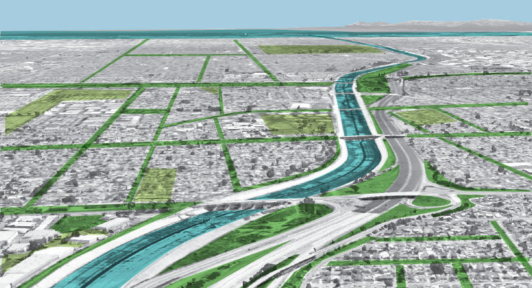
If we remember that streets,
parking lots, landscaped areas, and
lawns throughout the Gateway
Cities are direct extensions of our
rivers, we can utilize these
everyday landscapes as
opportunities to slow and absorb
stormwater, cleanse water that
ends up in our local rivers, and
sometimes, to even increase the
amount of water in our aquifers.
The benefits of watershed
planning are not just along the
rivers but throughout all our
everyday neighborhoods.
Planning For the Watershed
Through Greenscapes and Opportunity Sites shown elsewhere on this site, this vision plan suggests how everyday urban landscapes can help us to reenvision not only our rivers, but also our communities.
Many of the examples shown in this vision plan are chosen to show how our urban landscapes shape how our communities live together and interact.
This vision plan aims to support organization by presenting ideas to inspire, articles to provoke, and examples to consider. We pose the question, what do we love about the places we call home? We suggest that watershed health is closely linked with plants and soil that clean our water, and that green infrastructure can look many different ways and take many diverse forms.
We hope that expanding conversations about community priorities for each of the diverse cities of the Gateway Cities will also position local communities to leverage watershed funding opportunities for projects with multiple environmental as well as social and health benefits.
Here are some key elements of this vision plan:
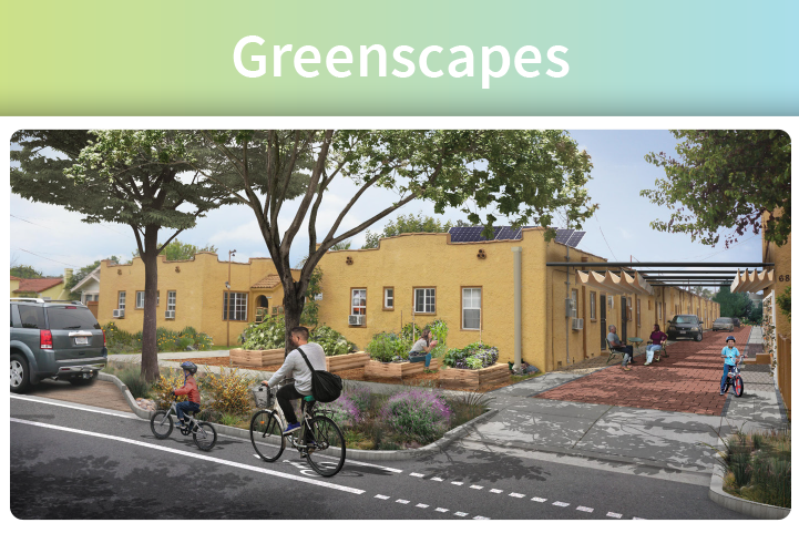
Greenscapes show a diversity of approaches to how green infrastructure might be integrated into typical landscapes of the Gateway Cities. One sample Greenscape was developed for each of the dominant land use types in the Gateway Cities. These visualizations are intended as touchstones for community discussion rather than as proposals for specific locations. We ask: how can green infrastructure enhance community values? How might investment in green infrastructure benefit the quality of life of everyone in our communities, from the youngest to the oldest, renters as well as homeowners?
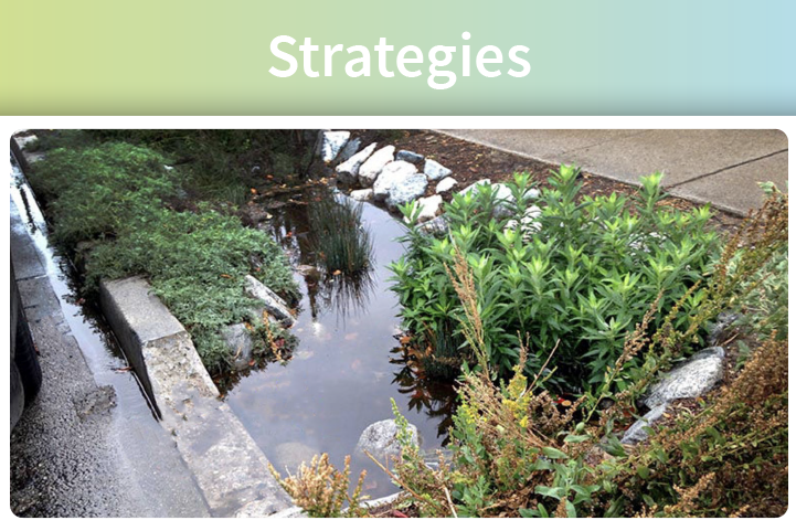
Strategies highlight greening methods that are low-impact and provide multiple benefits, including water capture, programming amenities, cooling, active transportation, habitat, parks, and open space.
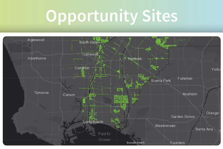
Opportunity Sites identifies possible Greenscape project locations within the 26 cities of the Gateway Cities region that, when implemented, can provide wide ranging benefits to the area’s climate, water resilience, air quality, health, equity, and education.
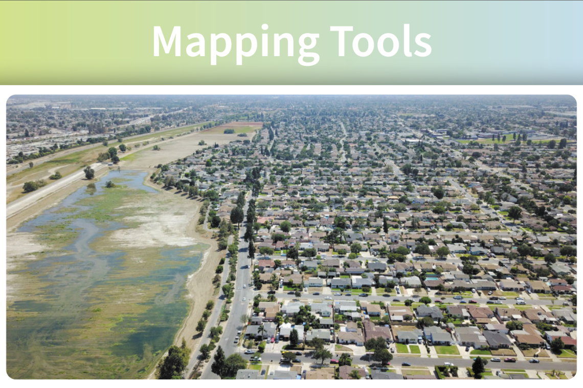
Mapping Tools provides GIS-based exploration of Gateway Cities projects, land use, demographics, and environmental challenges.
The challenges of urban development and climate in Southern California are not unique to the Gateway Cities: regional challenges include ensuring the continued secure supply of water, air quality, improving waterways, cooling hot urban areas, providing parks and public community spaces, and realizing equity through such actions as policy to support people continuing to live in their neighborhoods where these investments are made.
Yet, the communities of the Gateway Cities have always been characterized by adaptability and evolution.
This vision plan offers green infrastructure strategies that if implemented, promise to improve quality of life on a local level, while having regional scale impacts.
We invite feedback for how this vision plan and website might better facilitate the conversations that lead to community building, organizing, action, and even policy changes that can help guide the communities of the Gateway Cities toward a more sustainable future.
This vision plan aims to support
organization by presenting ideas
to inspire, articles to provoke, and
examples to consider. We pose the
question, what do we love about
the places we call home?
We suggest that watershed health
is closely linked with plants and
soil that clean our water, and that
green infrastructure can look
many different ways and take
many diverse forms.
*Note: The cities of Industry and Avalon are not included within the scope of this project.
Made with ❤️ by TreeStack.io
