What Is Watershed Planning?
We are all connected through watersheds. Watershed planning is not just about streams, rivers, and oceans. Watershed planning is about the life we want to cultivate, and how our everyday places shape our everyday lives.
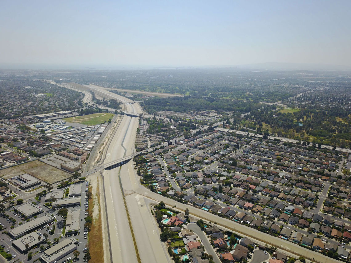
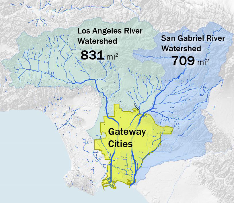
In the dense urban landscapes of the Gateway Cities, all everyday places are only a storm drain away from a river or stream. Parking lots, streets, and yards at home are all connected by the flow of rain down hill. All the places whose rainwater flows into the same body of water (usually a stream or lake) are considered part of the same watershed. All places in the Gateway Cities are considered to be part of the San Gabriel River or Lower Los Angeles River watersheds.
dji 0019copy

Because of this, every urban place, from homes to businesses, from parks to parking lots, and every outdoor activity that takes place in the entire Gateway Cities region directly or indirectly affects the quality of water in our rivers and ocean. Rainwater that falls on a roof in Downey will flow downhill, perhaps across a front yard, then onto a street, where it may continue to flow downward along the gentle gradient of the street, traversing an entire neighborhood, until a stormdrain routes it into an underground pipe, and then into a local river channel which then conveys the water to the ocean. Vernon’s industrial waterhouses may be a thirty-minute drive away from waterfront of Long Beach. Yet through a network of stormdrains that feed into the Los Angeles River, any activity on a Vernon parking lot has potential to directly impact the quality of the water in the ocean twenty miles downstream in Long Beach. These examples show how all urban communities are more closely connected to our rivers than we may imagine.
regional ws

In our rapidly changing world we are challenged to ensure that all have access to clean water and air, infrastructure to ensure health and safety, and efficient movement of people and goods that supports businesses while enriching our lives. In dense urban areas there is limited space and resources to realize the many benefits we value. Yet, from the scale of watersheds we can comprehensively consider these and other interconnected elements, air, water, climate, culture, ecology, economy, transportation, health, and safety. Planning from this broad watershed perspective is watershed planning. Watershed planning is a way for us to think about these challenges together, creatively, and effectively.
Take that rainwater that falls onto a roof in Downey. Imagine that instead of allowing this water to flow onto the street and into a stormdrain, that instead its journey became more complex. Imagine that instead of flowing onto a street, and washing all pollutants on the street into the nearest stream; that instead, the water flows from the roof and onto the leaves of plants, where it drops into a thick layer of mulch over earth shaped to help it soak deep into the soil, providing water to plants and other life. In the summer months, the breathing and shade of this plant life will then cool temperatures and clean the air so that children can play outside, and young people can jog without hurting their lungs. Imagine that at the same time, some of this same water continues to sink deeper below the ground, moving slowly through soil and along layers of rock, until some of it sinks deep underground, and ends up helping to replenish an aquifer which is a main local source of municipal drinking water for the Gateway Cities region.
Through this one example scenario, the simple act of capturing the rain that fell on a single roof, has led to increasing the greenery in a residential neighborhood. This greenery then cools a residential street in the summer time, which then makes being outside more comfortable and safer for people, which then helps people to be outside in their own neighborhoods more, supporting the health of people that live there. Meanwhile, rainwater has been filtered through the soil before it reaches our local rivers, making our river waters safer for fish as well as people, making our rivers the backdrop suitable for urban parks, and even helping to reduce flood flows. Some of the water, that in many places trickles deep into underground aquifers, can help to reduce our region’s dependence on imported water. Thinking on a watershed scale allows us to see the interconnectedness of all elements in our urban landscape, and envision simple but holistic solutions that have far reaching positive impacts.
The main channels of our region’s great waterways (The Los Angeles and San Gabriel Rivers) have recently been recognized for their potential to increase open space and contribute to healthy lifestyles along riverfront communities. The Lower LA River Revitalization Plan was recently completed, and a update of the 2001 master plan for the San Gabriel River is underway. However, it’s important to realize that watershed planning is not just about our river channels. It is about all our urban neighborhoods that are connected through our waterways. It is about how everyday places shape the lives of people who live in them, how we organize ourselves into communities, and shape our communities’ health in the present and far into the future.
What kind of meaning do our
everyday urban landscapes have
for us? What kinds of relationships
among us do our current urban
landscapes create? What
aspirations do we have for the
future?
DJ Waldie, chronicler of life in
Lakewood, told us that he sees his
own storytelling as a foundation
for visioning about the future of
our communities: “Our stories of
where we live are the initial steps
in planning for what they will be
tomorrow.”
We have compiled some of stories
of the everyday urban landscapes
that connect us in Local Voices.
Made with ❤️ by TreeStack.io
