Neighborhood Creeks
More Than A Ditch
Streams and creeks of the past still flow under and through our neighborhoods. The concrete “ditch” you see today was once a thriving natural waterway, supporting all types of plants and aquatic life. Although the nightly chorus of frogs may be gone, we can still open these creeks to greenway trails, restoring the connections between neighborhoods and schools, parks, churches and commercial centers.
greenscape title visualizing2

The Coolest Places of All
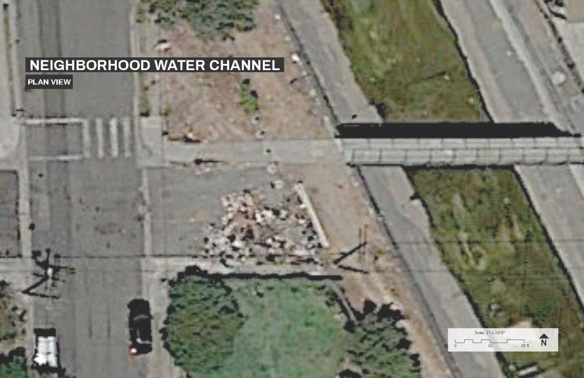
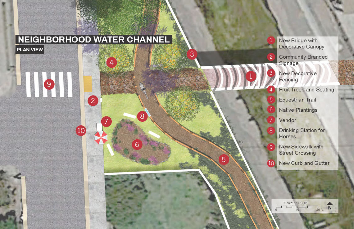
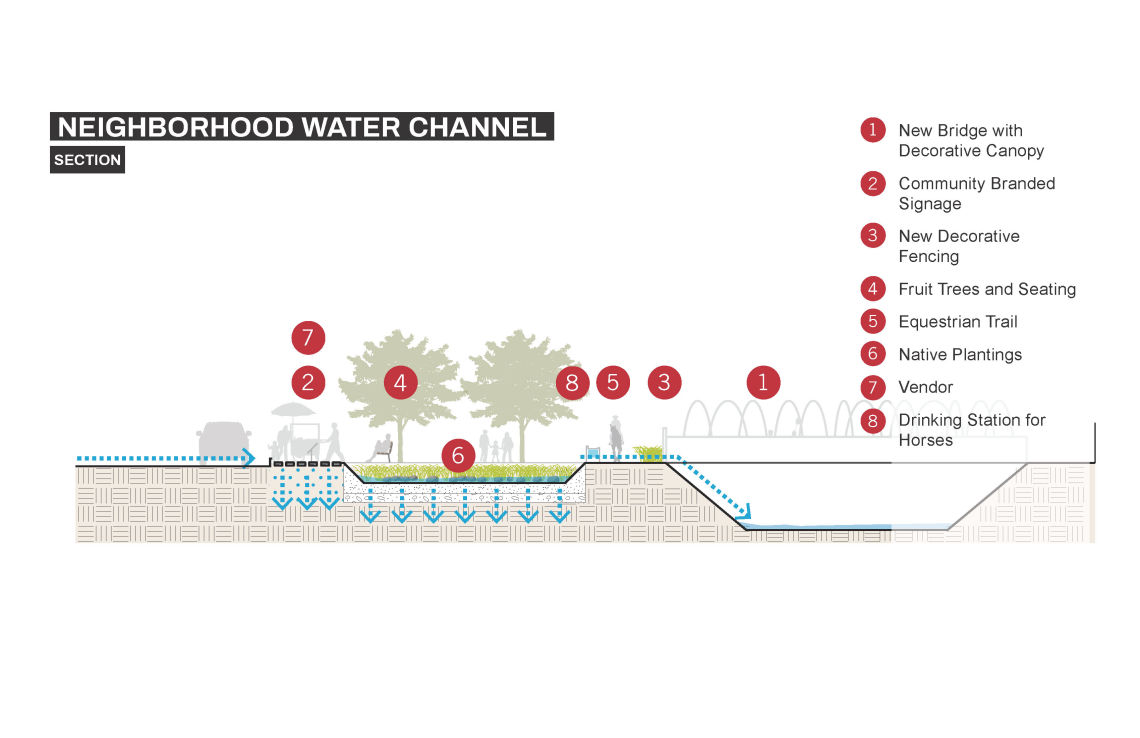
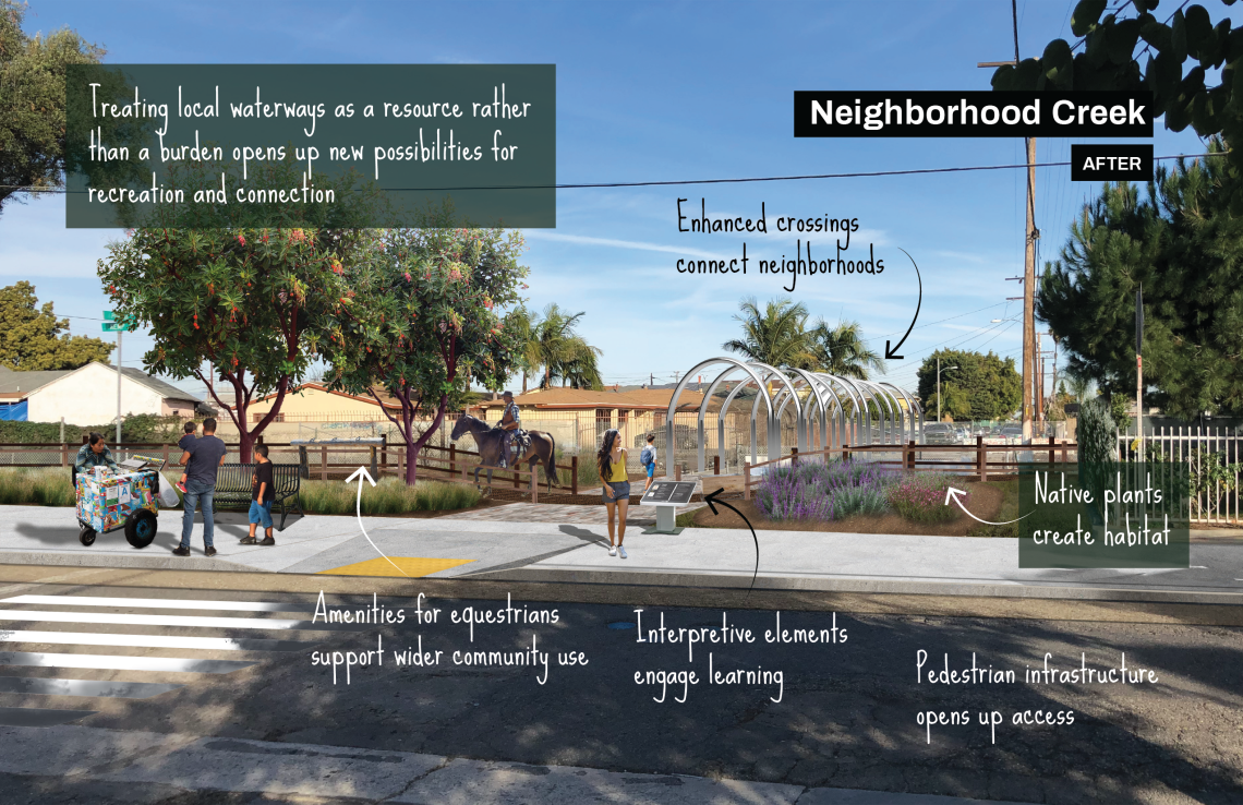
↓Every spot of earth where water flows can support thriving soil and plants—no matter how small. Underutilized easements that run along narrow concrete stream channels might accommodate trails and small parklets that might capture rain, support greenery, and offer respite from busier urban places.
Connecting Communities
↓Connecting our neighborhoods through corridors of cooling, offers more spaces to be outside, play, walk, and bike. Revitalized waterways support healthy communities.
Waterways Welcome All Species
↓Wetlands and streams support more kinds of life than any other habitat, but less than 5% of these original habitats remain across Los Angeles County[1]. Hundreds of species still depend upon them, and it is up to us to welcome these species back to the land in which they once thrived.
greenscape title onthemap

Neighborhood Creeks are 'local' creeks, which are not regional in nature. In the Gateways Cities, they include all small tributaries off larger channelized creeks and washes (including Upper Compton Creek)—but not regional waterways such as the Los Angeles River, San Gabriel River, Rio Hondo, Coyote Creek, and Lower Compton Creek.
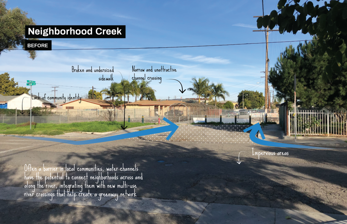
Where these creeks can often be seen as a barrier or disruption in a neighborhood, this greenscape represents an opportunity to bring active transportation options, trail access, safe crossings, and active health benefits. Scroll around and zoom into the map to see Neighorhood Creeks throughout the Gateway Cities region. You can also use the layers panel (top left) to toggle on and off all greenscape types. Where are the opportunities in your neighborhood?
greenscape title examples

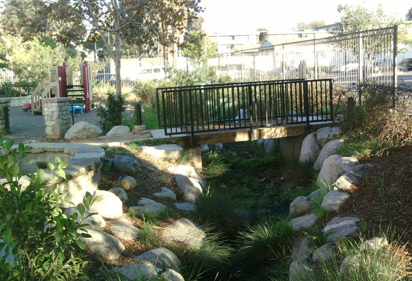
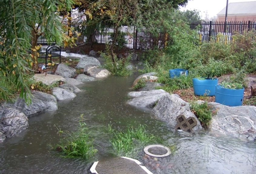
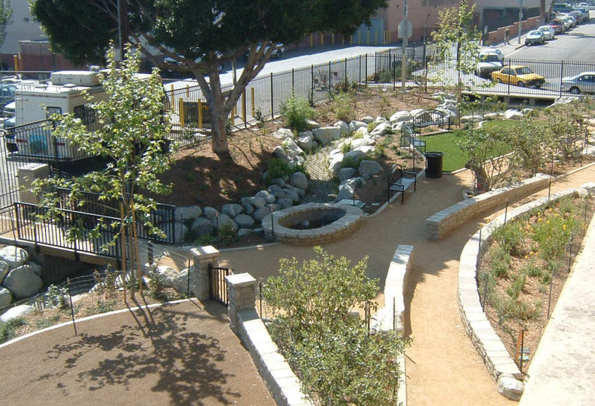
A 180-foot swale defines Bimini Slough Ecology Park—a small pocket park developed by North East Trees for the Bresee Foundation, recalling the wetland that once ran through the area. The project provides natural surfaces and open space along what had been a neighborhood storm drain for an almost 8-acre drainage area.
Reflecting on a conversation about water capture projects and the park, Emily Green of the Los Angeles Times wrote, “[N]o matter how many rain barrels we put out and percolation pits we dig, many homeowners can do only so much in compensating for the absorptive and cleansing power of lost streams.”
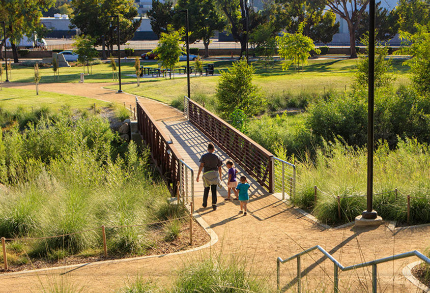
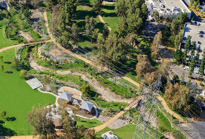
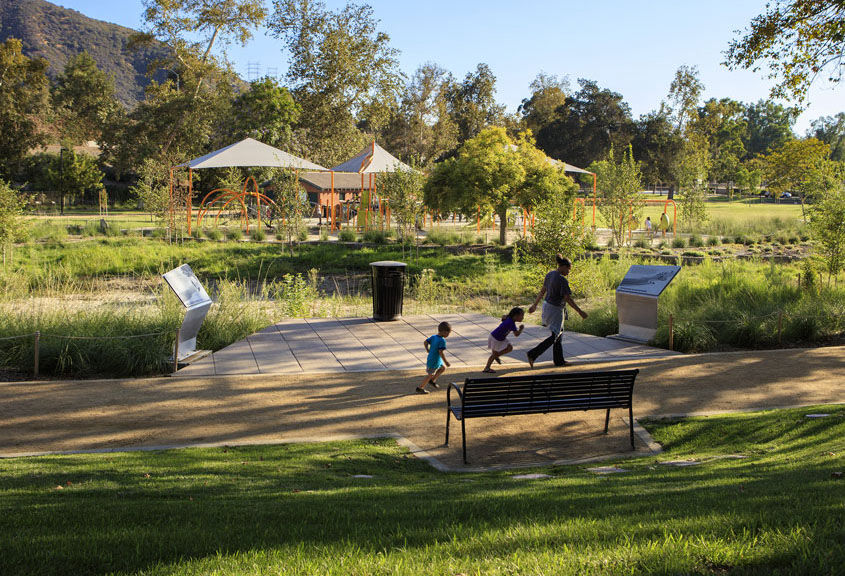
The Johnny Carson Park Revitalization Project, in Burbank, focused on the restoration of the Little Tujunga Wash Creek, which flows into the Los Angeles River and traverses the park. The creek is now a destination with enhanced habitat, recreational access, and water quality, as well as new walking paths with parcourse equipment and improved accessibility, bridges crossing the creek, picnic areas, new LED lighting, an expanded children’s play area, new acoustic concert stage, California native plant palette, and reclaimed water irrigation.
“We articulated a vision to the City [Burbank] for transformation of an existing concrete storm channel into a restored natural stream— a historic water body: the Little Tujunga Wash, a tributary of the Los Angeles River that conveys a significant portion of urban runoff from Burbank into the river itself. Transforming this gutter into a natural system would provide not only local benefits of habitat restoration and aquifer recharge, but also regional benefits by lessening the demand on the Los Angeles River itself.” —AHBE, Landscape Architects
_______
Have a successful example you'd like featured in this vision plan? Fill out this form and let us know!
greenscape title resources

Planning and Design
County of Los Angeles Trails Manual. County of Los Angeles Department of Parks and Recreation, Planning and Development Agency. (2013).
The County of Los Angeles operates the main rivers and many of the tributaries across the Gateway Cities. County trails conform to the guidelines and standards in this resource, which may also serve as a resource for similar projects.
_______
California Rivers and Streams: The Conflict Between Fluvial Process and Land Use. Mount, Jeffrey F. (1995). University of California Press: London, England.
Resource on hydrology and fluvial geomorphology of waterways in our climate for water management restoration and improvement projects both large and small.
_______
San Gabriel River Master Plan. Moore Iacofano Goltsman, Inc. (2006). County of Los Angeles Department of Public Works.
The master plan for the San Gabriel River details priorities and projects for the primary corridor. These directives influence funding today, and are relevant for continued planning updates to both address regional challenges and advance a more climate-resilient future.
_______
Historical Ecology and Landscape Change of the San Gabriel River and Floodplain. Stein, Eric; Dark, Shawna; Longcore, Travis; Hall, Nicholas; Beland, Michael; Grossinger, Robin; Casanova, Jason; Sutila, Martha. (2007).
Historic ecology can inform design and planning of projects leveraging natural processes and features, and may also inform plant selections for projects of any type and scale.
_______
Tujunga-Pacoima Watershed Plan. The River Project, PBS&J, Tetra Tech, Inc., Larry Walker Associates, Everest International Consultants, Los Angeles & San Gabriel Rivers Watershed Council, and National Park Service, Rivers Trails & Conservation Assistance Program. (2008).
Example of a watershed approach providing comprehensive background from expert inventory collection and meaningfully engaging local stakeholders to identify priorities and projects which continues to be a success: 23 of 37 preferred projects have already been implemented or are in development as of October 2018.
_______
Los Angeles River Community Design. The River Project. (2002).
This project details the planning for the improvement of a limited urban creek easement in a portion of the LA River above the Tujunga Wash, where the river shares characteristics of smaller community waterways throughout the Gateway Cities. The participatory process of engaging local stakeholders and local school children (future project users) was foundational for the ongoing success of the project. Stakeholders were able to learn about relevant factors and inform the process with their priorities, which has resulted in continued community investment, and the advancement of similar projects in the area.
_______
Coyote Creek Bikeway Project: A Feasibility Assessment and Implementation Guide. Trails4All, California Resource Connection, Inc., Los Angeles County Bike Coalition, and National Park Service, Rivers, Trails & Conservation Assistance Program. (2008).
A collaborative process was instrumental in the development of the guidelines and standards for Coyote Creek that flows along the southeast corner of the Gateway Cities.
Ecology of the Gateway Cities And Climate Appropriate Plant Material
Landscaping Guidelines and Plant Palettes. Los Angeles and San Gabriel Rivers Watershed Council and Rancho Santa Ana Botanic Garden. (2004). County of Los Angeles Department of Public Works.
This document applies to the Los Angeles and San Gabriel Rivers. Guidelines include specifications for trail and landscape improvements.
_______
Calscape. California Native Plant Society. (2018).
Excellent resource for planting design. Inventory of native plants, profiles, and conditions relevant to plant material by specific location and historic distribution (elevation, precipitation, average high and low temps).
_______
San Gabriel River Plant List. O’Brien, Bart. (2007).
This list was developed as an update for the San Gabriel River plant palette to replace the Landscaping Guidelines and Plant Palettes for the Los Angeles River. The research and recommendations are relevant throughout waterways and upland areas of the Gateway Cities.
Sources:
[1] Faber, Phyllis; Keller, Ed; Sands, Anne; Massey, Barbara. 1989. The ecology of riparian habitats of the southern California coastal region: A community profile.
Made with ❤️ by TreeStack.io
