Infrastructure Corridors
Greenways From Leftover Spaces
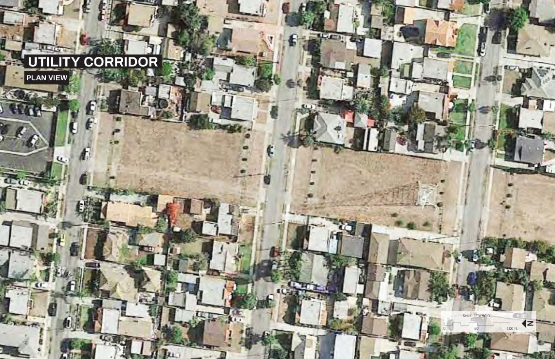
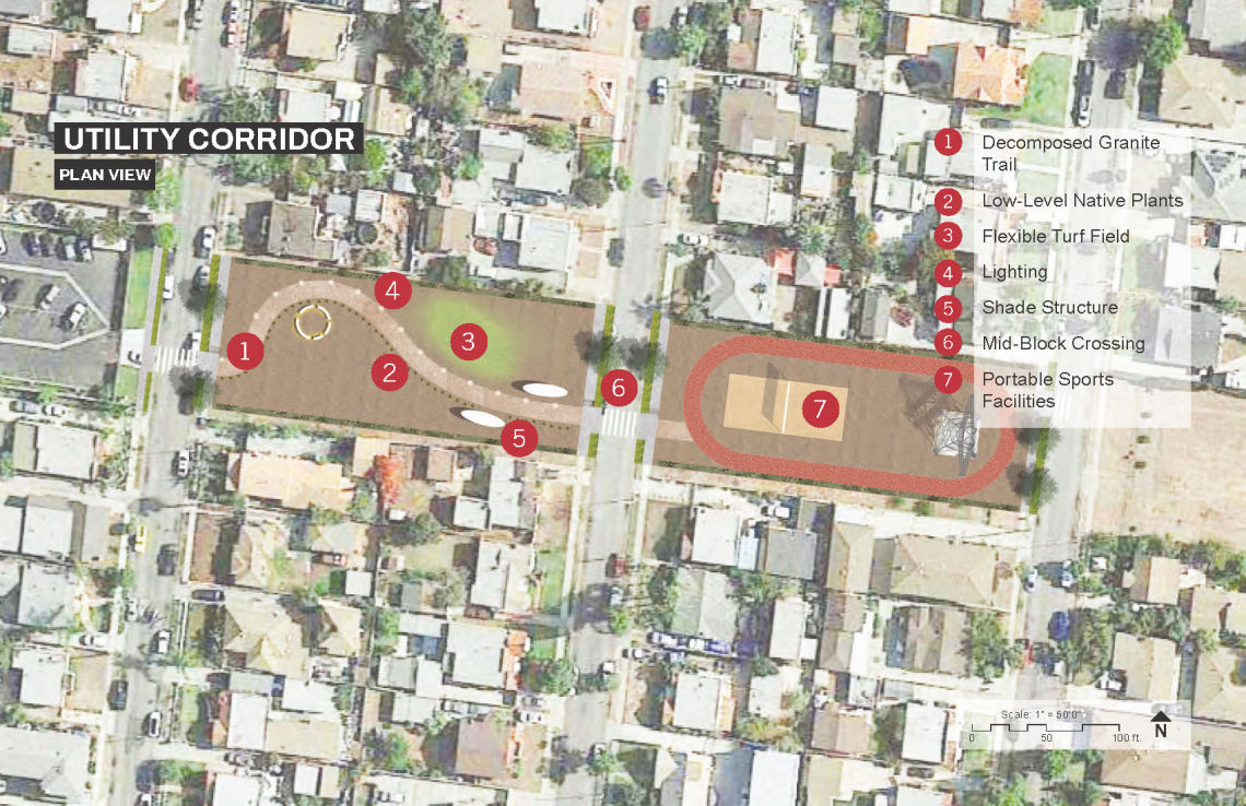
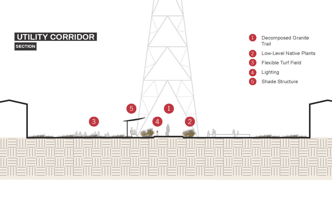
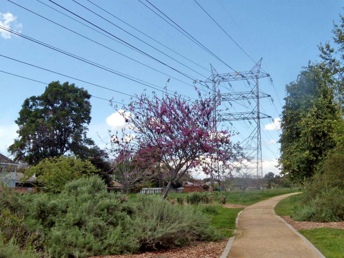
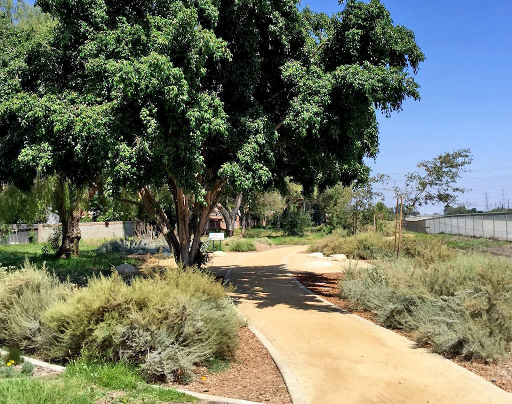
Rail lines and electrical corridors run through many of our densest neighborhoods and take up a lot of space. Yet these spaces could also be used by people to relax, play, or soak up the sun. Communities are beginning to transform abandoned rail lines into popular trails and the spaces below electrical corridors into parks and community gardens, forming long swatches of accessible greenways along our rivers and throughout our communities.
greenscape title visualizing2

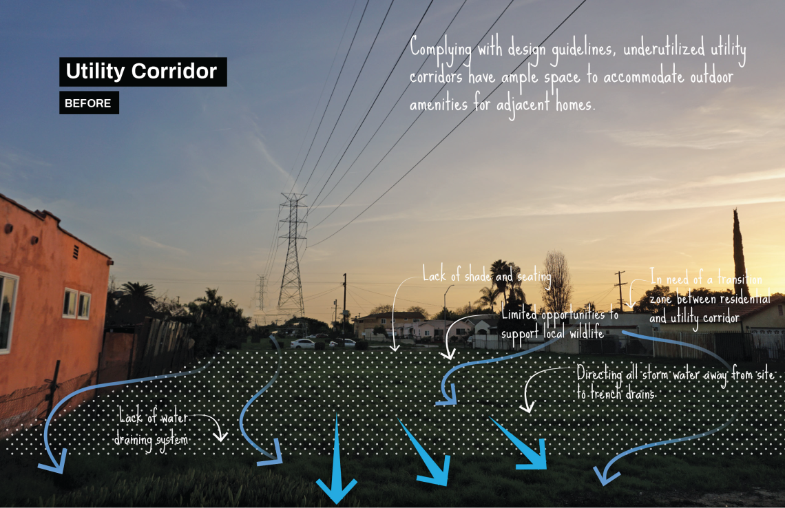
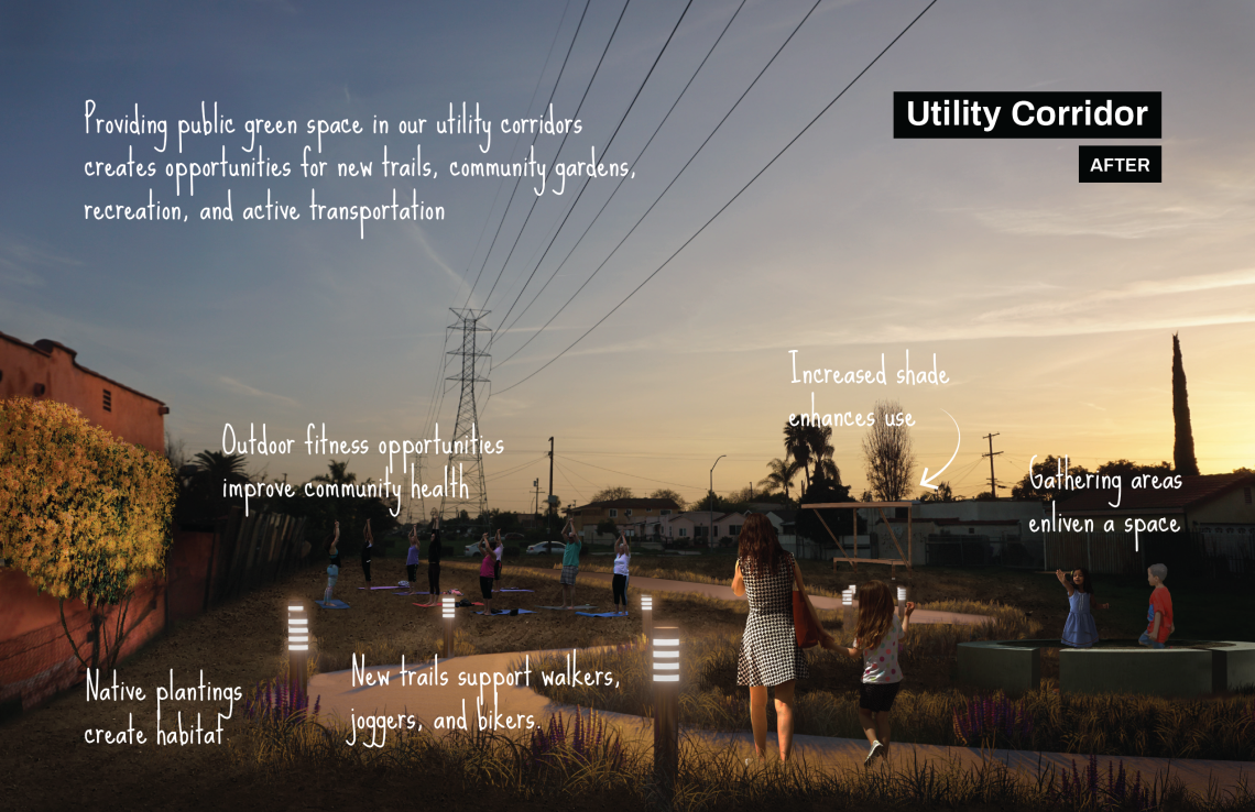
A Place For Native Plants, Community Gardens, and Trails
↓Large, underused belts of land (in the form of utility corridors) already run through many of the densest of our neighborhoods. What green uses do you hope to see in your community?
Car Free Alternatives
↓Infrastructure corridors have potential to provide connections with a larger network of multi-use trails and open spaces. What’s more, trails on infrastructure corridor remain relatively car-free.
Every Space is a Place
↓The San Gabriel River Corridor Master Plan (2006) calls for opening selected portions of river-adjacent utility corridors. Not only do the public benefit from trails and open space, but utility companies benefit from reduced maintenance costs.
greenscape title onthemap

The Infrastructure Corridors greenscape represents parcels with overhead public utility lines that are vacant or underutilized. It also includes parcels with railroad corridors that are either vacant or active but with additional right-of-way space for urban greening.
With thoughtful and community-based design, these corridors can be transformed into community gardens, local and regional greenways, pop-up programming, or linear parks that increase community green space. Scroll around and zoom into the map to see Infrastructure Corridors throughout the Gateway Cities region. You can also use the layers panel (top left) to toggle on and off all greenscape types. Where are the opportunities in your neighborhood?
greenscape title examples

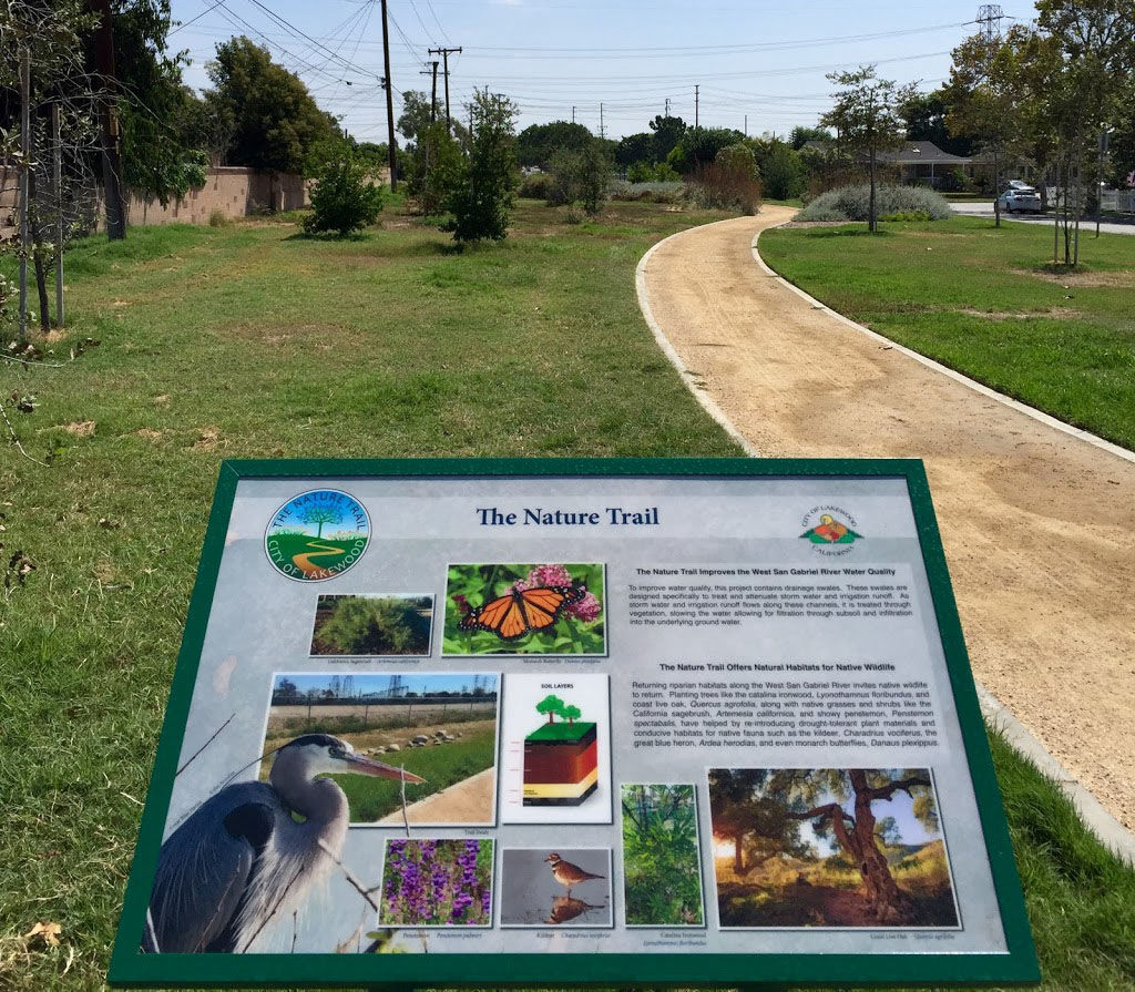
The West San Gabriel River Parkway Nature Trail in the City of Lakewood runs along a utility corridor on the San Gabriel River, directly adjacent to Monte Verde Park, and across the river from Rynerson Park. It features over a mile of paths, native and drought-tolerant trees, shrubs and wildflowers that provide habitats for birds and small mammals as well as a recreational nature experience for city dwellers. It also offers public access and linkages to the river.
"Our trail has flora and fauna that you would have seen in abundance in our region 100 years ago," said Mayor Wood on opening day, "but many have been pushed out by non-native species or loss of habitat in the years since. We've reintroduced them now on the trail and given residents the chance to see a little bit of what Lakewood and our region used to look like....and what we can still look like, when we take the time and effort to do so."
_______
Have a successful example you'd like featured in this vision plan? Fill out this form and let us know!
greenscape title resources

America's Rails-with-Trails: A Resource for Planners, Agencies and Advocates on Trails Along Active Railroad Corridors. Rails to Trails Conservancy. (2013).
Power lines along trails: Examples of electric transmission lines in shared utility corridors with trails, railtrails, and greenways. Macdonald, Stuart. (2018). American Trails.
Trails and Pathways to Enhance Recreation and Active Transportation. Centers for Disease Control and Prevention. (2018).
Made with ❤️ by TreeStack.io

