Urban Rivers
Reconnecting Communities to River Greenways
Some of the most amazing and memorable places are along rivers. But access to our urban river trails can be limited and parks are often spaced sporadically, making them feel less welcoming. By greening underutilized spaces along the edges of our rivers, we can serve the needs of people and increase habitat for wildlife.
greenscape title visualizing

The Coolest Places of All
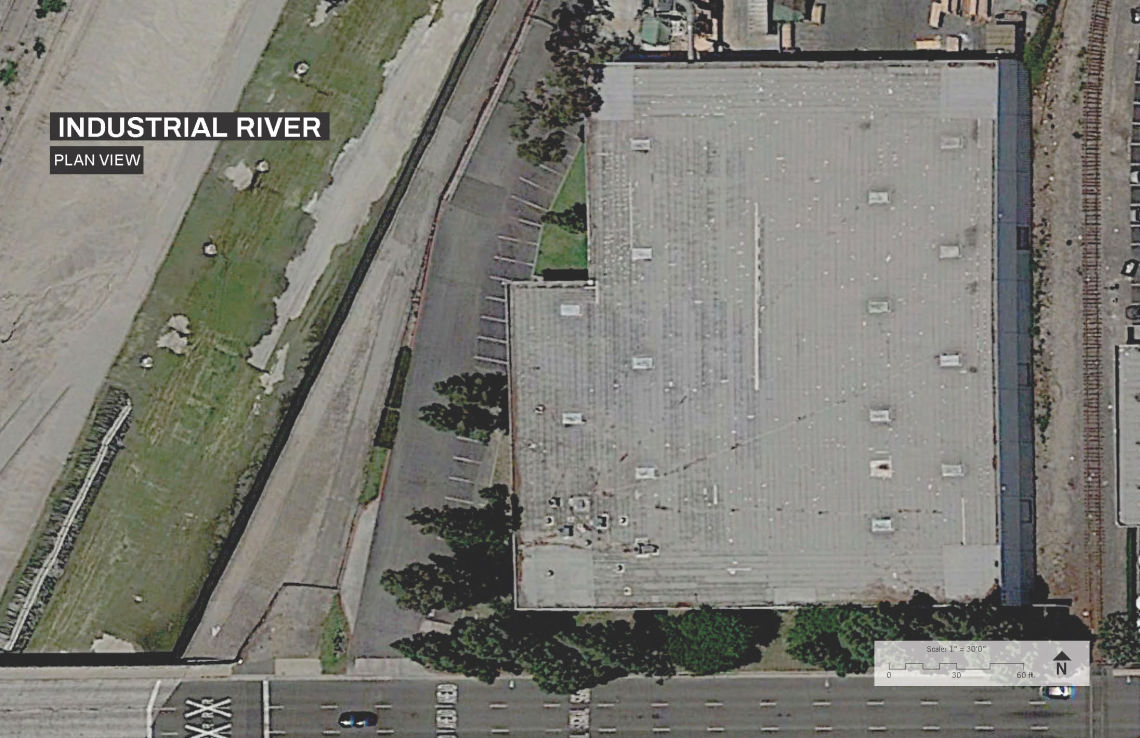
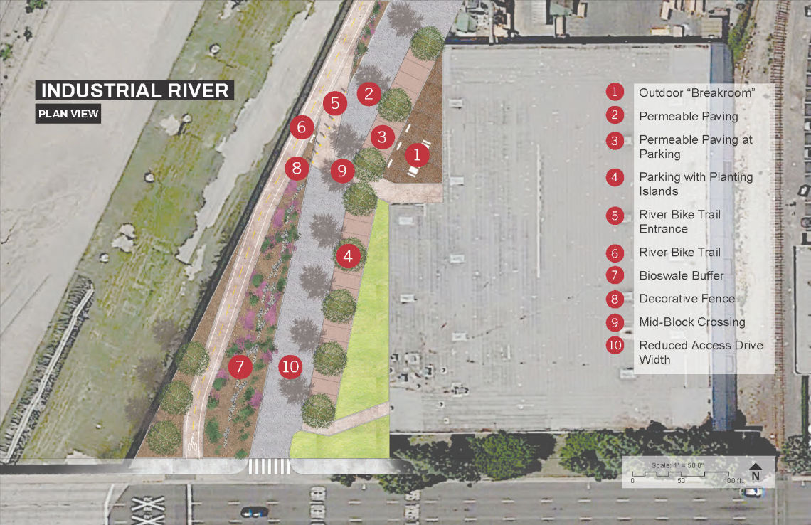
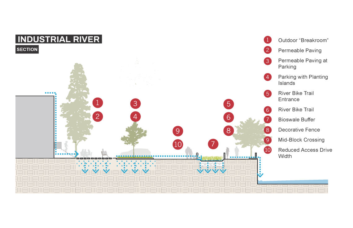
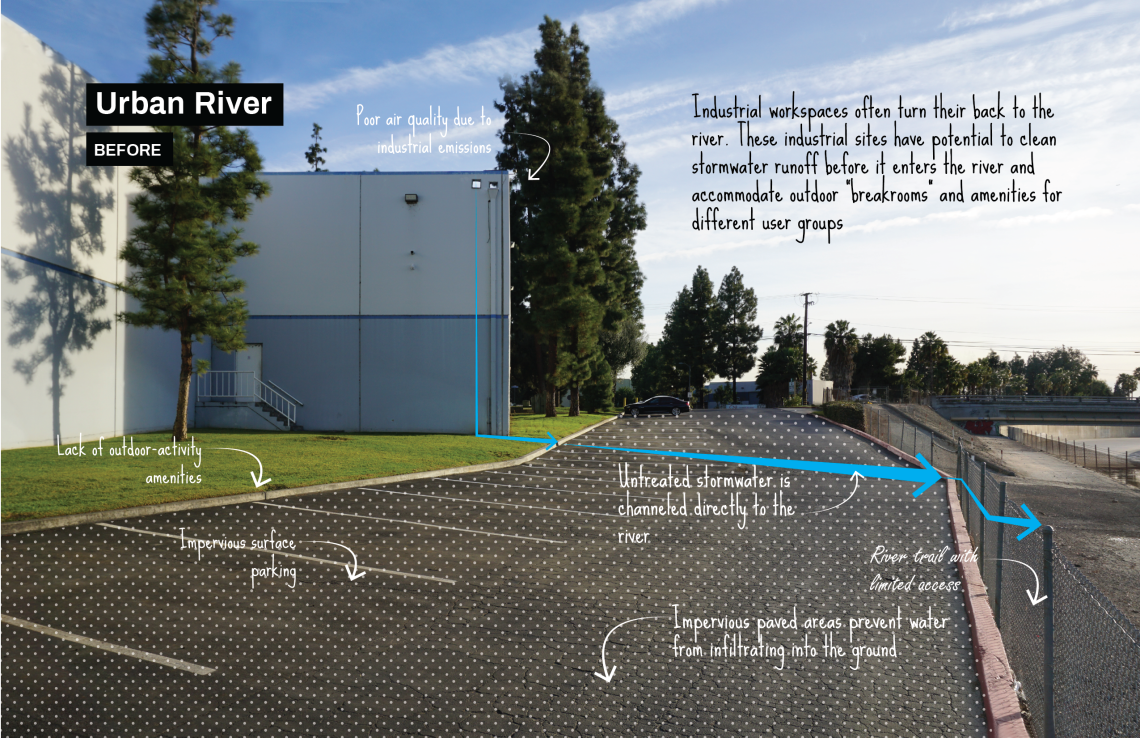
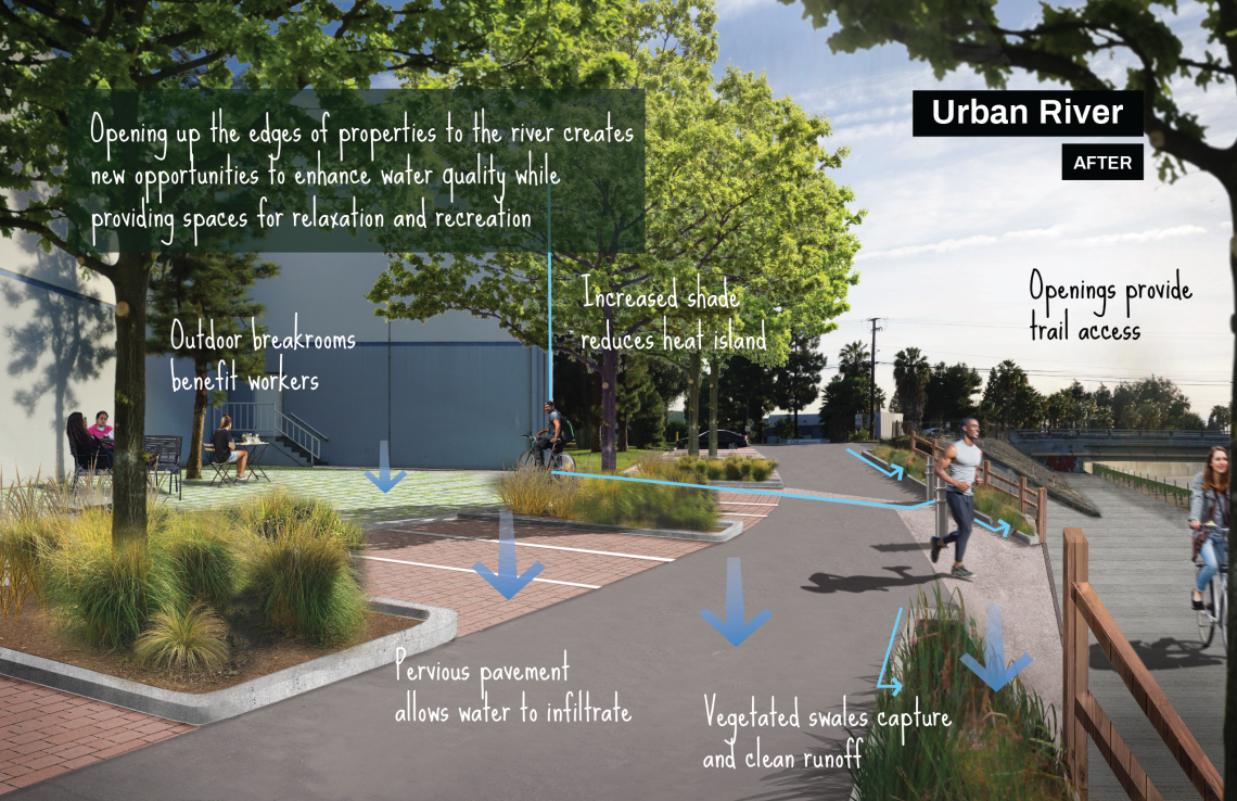
↓Every spot of earth where water flows can support thriving soil and plants—no matter how small. Underutilized easements that run along narrow concrete stream channels might accommodate trails and small parklets that might capture rain, support greenery, and offer respite from busier urban places.
Connecting Communities
↓Connecting our neighborhoods through corridors of cooling, offers more spaces to be outside, play, walk, and bike. Revitalized waterways support healthy communities.
Waterways Welcome All Species
↓Wetlands and streams support more kinds of life than any other habitat, but less than 5% of these original habitats remain across Los Angeles County[1]. Hundreds of species still depend upon them, and it is up to us to welcome these species back to the land in which they once thrived.
greenscape title onthemap

The Urban Rivers greenscape includes parcels adjacent to the major Gateway Cities waterways including the Lower Compton Creek, Lower Los Angeles River, San Gabriel River, Rio Hondo and Coyote Creek. These parcels are classified as vacant land, industrial, commercial, or mixed-use residential commercial, but exclude private housing (except for mobile home communities). Parcels were prioritized based on a 'distance shed'— which means giving priority to segments of the rivers that require walking a further distance to an existing trailhead. Ideally, community members would have access to river trails at least every quarter mile.
By focusing on these often neglected river-adjacent parcels, we can create 'front-facing' river amenities, including adding trail heads, pocket parks, and rest stops — and building awareness of urban rivers as spaces to bike, walk, and experience a more natural environment. Scroll around and zoom into the map to see Urban Rivers parcels throughout the Gateway Cities region. You can also use the layers panel (top left) to toggle on and off all greenscape types. Where are the opportunities in your neighborhood?
greenscape title examples

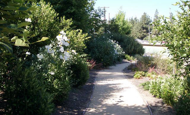
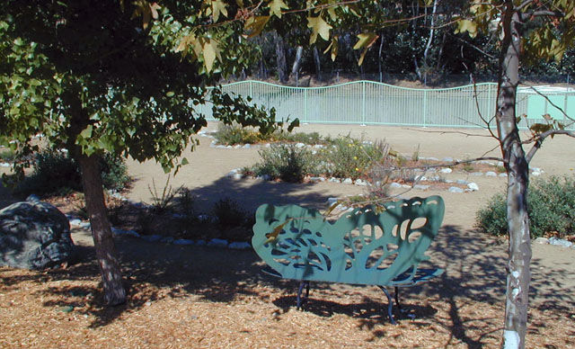
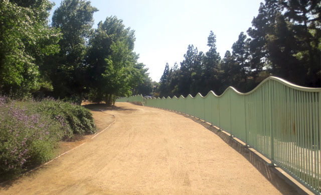
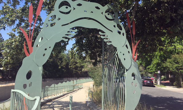
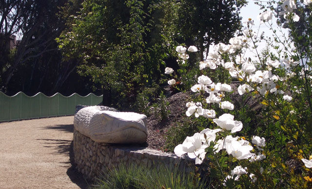
The south bank of the County-operated Valleyheart Greenway in Studio City was the second stretch of vegetated greenway developed along the Los Angeles River in the City of LA. The project was the result of working directly with local school children, who inspired the art, design elements, and layout of a small oasis of habitat by maximizing the area covered by healthy soil, native plants, and permeable surfaces which maximize natural benefits, while minimizing impacts and costs of more intensive interventions.
“The process we implemented is as important to document as the plans and recommendations. Participants learned about the river; they learned about watershed issues including stormwater management, and were provided with tools to integrate these elements into an actual plan for the Valleyheart Greenway. They helped craft a plan that includes interpretive features, paths for both bicycles and pedestrians, community gathering areas, and native habitat areas to attract butterflies, pollinating insects and hummingbirds." — The River Project
_______
Have a successful example you'd like featured in this vision plan? Fill out this form and let us know!
“People already used the river. They walked their dogs. They walked to school. They took their lunch breaks. Even though it wasn’t (still isn’t) pretty to look at, there was something about the river that brought them”
—Los Angeles River Community Design, The River Project, 2002
Benefits
greenscape title resources

Lower Los Angeles River Revitilization Plan. Lower Los Angeles River Working Group (2017).
Los Angeles River Master Plan. Los Angeles County. (2021).
Los Angeles River Master Plan. Los Angeles County. (1996).
San Gabriel River Corridor Master Plan. Los Angeles County. (2006).
Los Angeles River Revitalization Master Plan. City of Los Angeles. (2007).
Long Beach Riverlink. City of Long Beach (2007).
Common Ground: From the Mountains to the Sea. RMC + SMMC. (2001).
Trails and Pathways to Enhance Recreation and Active Transportation. Centers for Disease Control and Prevention. (2018).
Made with ❤️ by TreeStack.io
